Cart
0
Product
Products
(empty)
No products
To be determined
Shipping
0,00 Руб.
Total
Product successfully added to your shopping cart
Quantity
Total
There are 0 items in your cart. There is 1 item in your cart.
Total products
Total shipping
To be determined
Total


Range of Postcards

Range of Stamps
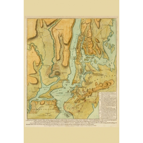
A Plan of New York Island, with part of Long Island, Staten Island & East New Jersey. Map Maker - William Faden, 1776.
Data sheet
| Size | 100х150 mm |
| Material | cardboard 270 g/m2 |
| Coating | oil varnish |
| Printing method | Offset printing |
| Back side | b/w form to fill messages |
More info
Faden's battle plan of New York is one of the most important broadside plans of the American Revolution and one of the most important graphic depictions of the history of the City of New York. The map shows the British & American Theater of War in Manhattan, the Bronx, Queens, Brooklyn and the north part of Staten Island, along with parts of Westchester County and New Jersey. The present example includes the land positions of the Americans in blue and the positions and movements of the British in red. At sea, the positions of the British naval vessels are shown, with the ships identified, in some cases more than once as positions changed during the course of the siege.
Waiting from postcrossing.com ...


